


MARION TWP Voting District, Beaver County, Pennsylvania
About
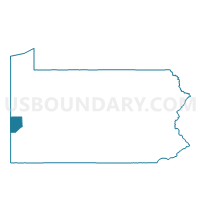
Outline

Summary
| Unique Area Identifier | 657148 |
| Name | MARION TWP Voting District |
| County | Beaver County |
| State | Pennsylvania |
| Area (square miles) | 10.48 |
| Land Area (square miles) | 10.25 |
| Water Area (square miles) | 0.24 |
| % of Land Area | 97.74 |
| % of Water Area | 2.26 |
| Latitude of the Internal Point | 40.78881120 |
| Longtitude of the Internal Point | -80.20821210 |
Maps


Graphs
Select a template below for downloading or customizing gragh for MARION TWP Voting District, Beaver County, Pennsylvania


Neighbors
Neighoring Voting District (by Name) Neighboring Voting District on the Map
- FRANKLIN TWP VTD EAST, Beaver County, PA
- FRANKLIN TWP VTD WEST, Beaver County, PA
- JACKSON TWP Voting District, Butler County, PA
- NEW SEWICKLEY TWP VTD UNIONVILLE, Beaver County, PA
- NORTH SEWICKLEY TWP VTD 02, Beaver County, PA
- NORTH SEWICKLEY TWP VTD 05, Beaver County, PA
- ZELIENOPLE VTD 02, Butler County, PA
- ZELIENOPLE VTD 03, Butler County, PA
Top 10 Neighboring County Subdivision (by Population) Neighboring County Subdivision on the Map
- New Sewickley township, Beaver County, PA (7,360)
- North Sewickley township, Beaver County, PA (5,488)
- Franklin township, Beaver County, PA (4,052)
- Zelienople borough, Butler County, PA (3,812)
- Jackson township, Butler County, PA (3,657)
- Marion township, Beaver County, PA (913)
Top 10 Neighboring Place (by Population) Neighboring Place on the Map
Top 10 Neighboring Unified School District (by Population) Neighboring Unified School District on the Map
- Seneca Valley School District, PA (46,966)
- Freedom Area School District, PA (11,105)
- Riverside Beaver County School District, PA (10,453)
Top 10 Neighboring State Legislative District Lower Chamber (by Population) Neighboring State Legislative District Lower Chamber on the Map
Top 10 Neighboring State Legislative District Upper Chamber (by Population) Neighboring State Legislative District Upper Chamber on the Map
Top 10 Neighboring 111th Congressional District (by Population) Neighboring 111th Congressional District on the Map
Top 10 Neighboring Census Tract (by Population) Neighboring Census Tract on the Map
- Census Tract 6018, Beaver County, PA (7,360)
- Census Tract 9118, Butler County, PA (6,189)
- Census Tract 6058, Beaver County, PA (6,120)
- Census Tract 6051, Beaver County, PA (4,965)
- Census Tract 9119, Butler County, PA (4,702)
Top 10 Neighboring 5-Digit ZIP Code Tabulation Area (by Population) Neighboring 5-Digit ZIP Code Tabulation Area on the Map
- 15010, PA (28,425)
- 16117, PA (17,185)
- 15066, PA (12,785)
- 15074, PA (8,874)
- 16063, PA (6,559)
- 16123, PA (2,237)